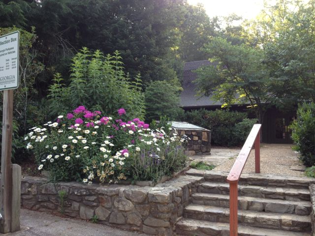
LOCATION: 418 Amicalola Falls St Pk Road Dawsonville, GA 30534 Park: (706) 265-4703 LENGTH: 12 miles of trails TYPE: Loop RANKING: Easy to Strenuous ACCESS: 7 am - 10 pm USAGE: Heavy at times FEES: $5.00 parking fee or purchase an annual ParkPass MAPS: Yes at Trading Post SURFACE: Packed soil FEATURES: Spectacular waterfall COMMENTS: Steps are metal and difficult for dogs PET FRIENDLY: Yes
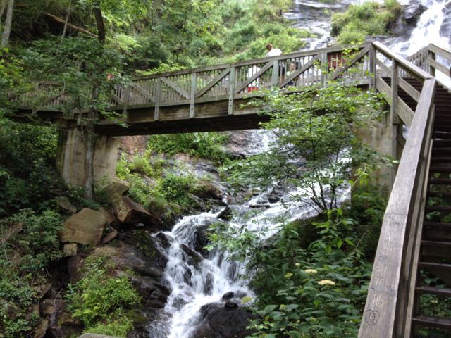
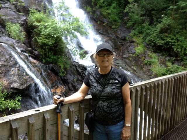
I can't say enough about this Georgia State Park. It has the highest waterfall in Georgia and is magnificent. The name "Amicalola" is derived from a Cherokee word meaning "tumbling waters."
In 1957 the Appalachian Trail Club rerouted the start of the Appalachian Trail to Springer Mountain. The park began to serve as the access point for hikers.
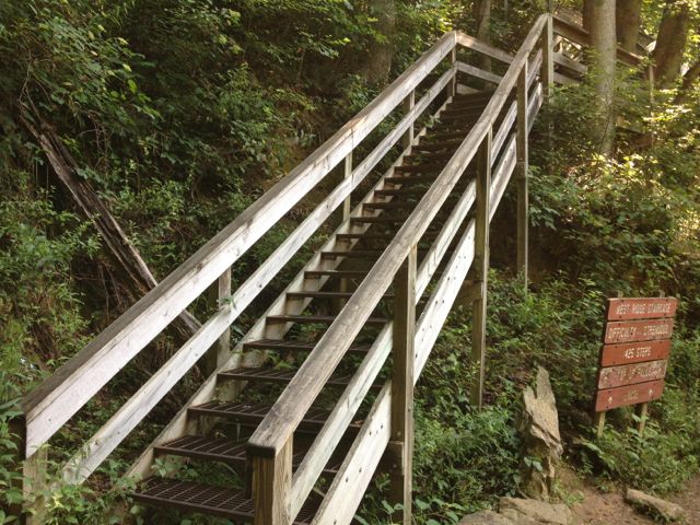
There are several trails here ranging from easy to strenuous. The Base of the Falls Trail is 8.5 miles. The first mile is 604 staircase steps and takes you to the falls overlook. From there you would join the old Appalachian Approach Trail. This trail is strenuous due to the steep slope and stairs. The stairs is also very difficult for dogs.
The Hike Inn Trail is 5.5 miles and rated moderate. It is the only access to the Len Foote Hike Inn and a permit must be obtained from the visitor center to hike this trail.
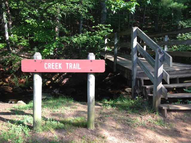
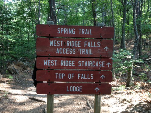
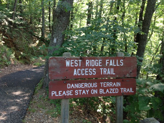
In June 2012 we hiked starting at the Creek Trail and turning left onto the Mt Laurel loop. We were able to pick up the Springer Trail. This will take you across a parking lot to the West Ridge Falls access to the base of the falls.
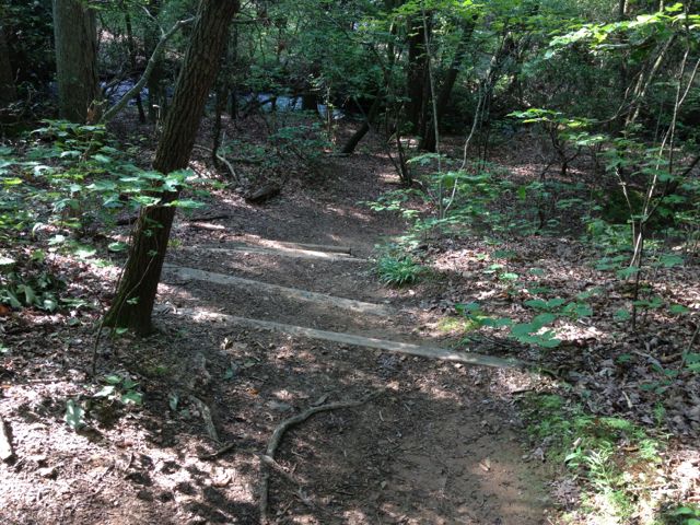
This trail is rocky with lots of roots and of course uphill all the way. It's all worth it to see the beautiful waterfall and feel the spray.
Returning down we had 145 steps to reach the trail and then followed the Appalachian Approach Trail past the reflecting pond.
The trails are well marked and the map is very easy to follow.
DIRECTIONS FROM ATLANTA: Travel GA 400 N to GA 53 towards Dawsonville. Turn right on Hwy 183 (Elliott Family Pkwy) and continue on Hwy 183 until it ends at GA-52. Turn right on GA-52 The entrance to the park is on the left about 1 mile past Burt's Pumpkin Farm.